Site and Situation and Ordnance Survey Maps
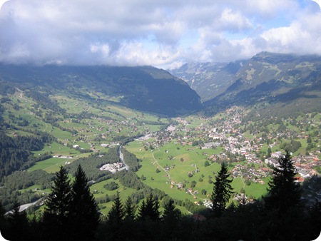
Image source: opengecko.com
The site and situation of a settlement are really important to understanding (a) why the settlement was located in a particular place in the first place and (b) whether or not the settlement was likely to grow over time.
You need to understand:
- the difference between the terms "site" and "situation"
- different factors affecting the site and situation of a place (usually, we think about the needs of the original settlers. In many parts of the world, we have to rewind many hundreds of years, and think about what people would have been looking out for when they decided to build a small settlement somewhere).
- how to recognise these factors through a map such as an ordnance survey map commonly used in the United Kingdom
First check your understanding by visiting these very useful web pages:
Settlement – Site and Situation at GeoBytesGCSE
GCSE Bitesize – Settlement Site and Situation
Geography GCSE: Settlements Site and situation – S-Cool
For some real examples, you could explore the middle ‘Site and Situation button’ here:
http://www.mrdgeography.com/Urban%20Geo/Urban_Geo.swf
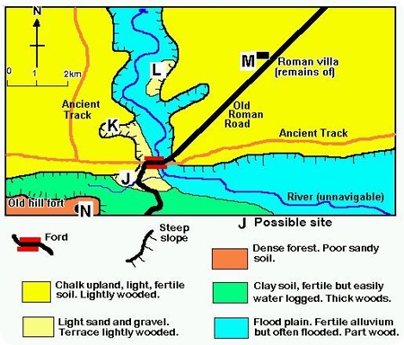
For a quick activity to check your understanding you could try evaluating the following sites on this imaginary map in terms of which might be better than others for locating a settlement. Make sure you can give reasons why.
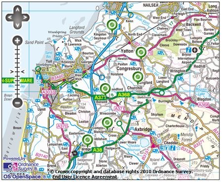
Now you could select a map (such as an OS map). A good example can be found in this area below, comparing six villages (near to the green dots). Click on the image below to take you to an interactive OS map on a separate page. Note that you can zoom in and out:
To help you evaluate different settlements’ site and situation factors, you can use the following framework. Note that this includes reference to ‘morphology’ which you may or may not have covered yet. If you have not covered settlement morphology (shape) yet, you can leave this out.
A direct link to this document for print (and save as pdf) is here:
Table to evaluate 6 settlements’ Site and Situation
When completing this table you should include as much information as possible. If the settlement does well under any heading, say why and give map evidence (including grid references). If you think the settlement would not score so highly on any row, again say why, and give good reasons. Finally, you may like to view the same area using a Google map with satellite view. Again, you can zoom in and out:
View Weston-Super-Mare Environs Site Situation Settlement in a larger map
| Print article | This entry was posted by James Penstone on March 11, 2010 at 9:17 am, and is filed under IGCSE Geography, Settlement. Follow any responses to this post through RSS 2.0. You can leave a response or trackback from your own site. |


